Search Results
Collection
Contains reports, plans and proposals, property surveys, block drawings, and photographic images shaping and documenting the physical development of San Francisco in the 20th century. Block...
Show moreContains reports, plans and proposals, property surveys, block drawings, and photographic images shaping and documenting the physical development of San Francisco in the 20th century. Block drawings were prepared in 1938 and 1939 for construction of a 3-dimensional model of the city. Subjects include height limits, urban design, lot sizes, rezoning, street connections, and redevelopment. Photographs consist of prints, negatives, and color slides of neighborhoods, streets, and traffic scenes. Photo subjects include construction of the Work Projects Administration (WPA) Sectional Model of San Francisco and the Market Street transit thoroughfare.
Show less
Collection
The WPA Block Profiles of the San Francisco Department of City Planning Records contains original block drawings prepared for construction of a 3-dimensional wood model of the city. In 1938, the...
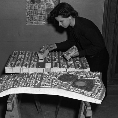
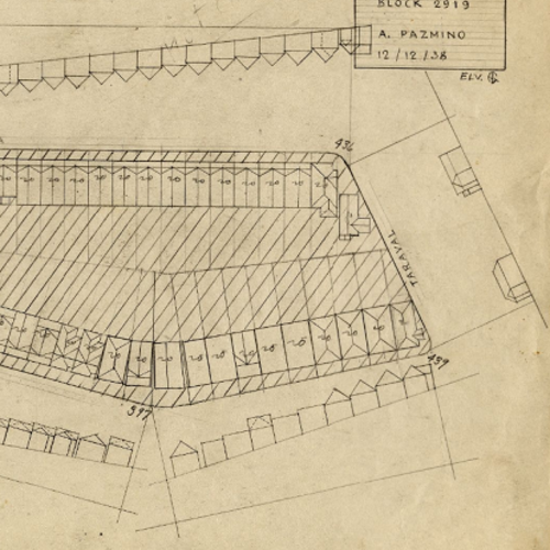
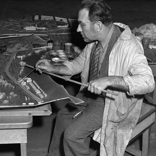
Show moreThe WPA Block Profiles of the San Francisco Department of City Planning Records contains original block drawings prepared for construction of a 3-dimensional wood model of the city. In 1938, the City Planning Commission sponsored this work. The relief map, called the WPA Sectional Model, was built by federal Work Projects Administration workers. The block drawings sometimes include the draftsman's name. A map, "Key to the WPA Sectional Model," is included. Generally, only one block appears on a sheet. The scale of the maps, as well as the model, is 1 inch = 100 feet, both horizontally and vertically. The drawings include building footprints, or outlines of buildings at ground level, and block-long street elevations at appropriate grade. The official grade elevation is stated in feet at corners, or where mid-block changes occur. Street addresses, lot sizes, and building uses are not given. The profiles can be used to determine a building's footprint and relative height in stories can be determined.
Show less
Collection
The Photographs and Negatives series of the San Francisco Department of City Planning Records includes approximately 1,200 photographic prints, 1,000 negatives and 120 color slides of San Francisco...
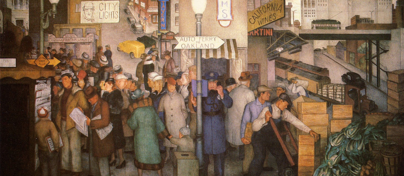
Show moreThe Photographs and Negatives series of the San Francisco Department of City Planning Records includes approximately 1,200 photographic prints, 1,000 negatives and 120 color slides of San Francisco's neighborhoods, streets, and traffic scenes between 1939 and 1995. The earliest negatives document the construction and dedication of the Work Projects Administration (WPA) Sectional Model of San Francisco, 1939-1940.
Show less