Skip to main content
SEARCHING
Collections
Advanced Search
Search Term
SEARCH
Search Term
SEARCH
Advanced Search
San Francisco (Calif.)--Photographs
(x)
Real property--Maps
(x)
Search Results
Search Results
Displaying
1 to 15 of 15
results for ' '
Sort By:
Title
Relevancy
Date Added
Date Created
Islandora List
Grid
For:
LCSH Subjects = San Francisco (Calif.)--Photographs
Topic = Real property--Maps
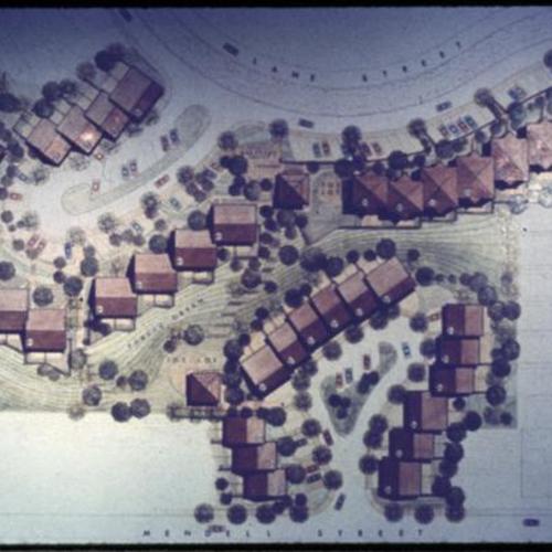
Hunters Point site 3 site plan
Hunters Point Project Area A
Hilltop playground vicinity map plate 1
Hunters Point Project Area A
New Hunters Point Community progress map
Hunters Point Project Area A
Hunters Point Tentative staging program
Hunters Point Project Area A
Hunters Point housing phase one map with unit totals
Photographer
Hunters Point Project Area A
Hunters Point site 2 site plan
Hunters Point Project Area A
Diamond Heights Projected Area Tentative Redevelopment Plan Plate 3
Hunters Point Project Area A
Hunters Point master plan
Hunters Point Project Area A
Site and unit totals
Hunters Point Project Area A
Treasure Island property planning map
Photographer
United States Naval Station Treasure Island Photographs
Condition of structures in Yerba Buena boundaries
Yerba Buena Center Project Area D-1
Fires in hotel structures in Yerba Buena boundaries
Yerba Buena Center Project Area D-1
Yerba Buena Center Map
Yerba Buena Center Project Area D-1
Yerba Buena Center map
Yerba Buena Center Project Area D-1
Yerba Buena Center map
Yerba Buena Center Project Area D-1
Type of Resource
still image
(15)
Genre
Color slides
(14)
Photographs
(1)
Topic
Bayview-Hunters Point (San Francisco, Calif.)
(2)
Building sites
(1)
Diamond Heights (San Francisco, Calif.)
(1)
Fires
(1)
Hotels
(1)
Islands
(1)
Landscape architectural drawing
(7)
Urban renewal
(5)
Subject
San Francisco (Calif.)--Department of Public Works
(1)